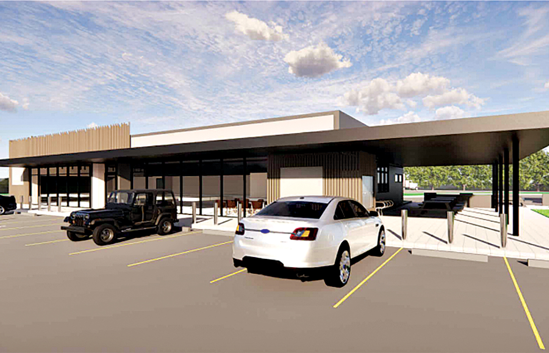
BULLSBROOK residents are raising their concerns about a planned 24 hour roadhouse proposed for Lot 31 (1487) Neaves Road including that there is an insufficient buffer proposed.
The proposed development is across the road from where Margaret Carlton and Tony Lindsay have lived for 19 years.
The $3 million proposal is due to be reconsidered by JDAP on January 16, but Ms Carlton and Mr Lindsay believe they will be negatively affected if it goes ahead.
Their house is about 30m from the road front and they said their rural amenity could be lost due to odours, noise and lighting at night from the proposed service station.
They thought state planning policy 4.1 recommended a generic buffer zone of 200m between 24 hour truck stops-service stations and residences due to these emissions.
“We are well within this buffer zone as are two other residences,’’ they said.
“Also, although Neaves Road is busy during the day it is quiet at night.
“The noise from vehicles, particularly trucks, slowing down, entering and then leaving throughout the night would be excessive.
“There are no street lights on Neaves Road so it is quiet and dark at night.
“The lights, including a proposed 9m sign would directly affect our home, our animals and the wildlife we have on our property.
“Further, the proposed site will be elevated over a metre further increasing the effect of odours, noise and lights.’’
The responsible authority report prepared by the city for the JDAP and presented to the council in December discusses setbacks from the road but does not mention any buffer between the proposed roadhouse and nearby residences.
The responsible authority report for the January 16 meeting – available online here – on page 17 says state planning policy 4.1 sets out the buffer requirements for land uses that have the potential to generate off-site emissions in order to provide for the safety and amenity of surrounding sensitive land uses but the state planning policy 4.1 does not mention the word buffer.
It also says the Environmental Protection Authority (EPA) has prepared a guidance note entitled Separation distances between industrial and sensitive land uses to assist in the implementation of state planning policy 4.1 but those EPA notes, which are only a guide, have been in existence since 2005.
An officer’s report prepared for the city’s December meeting last year said the proposal largely complied with the development standards outlined in the city’s local planning policy POL-TP-126 but entailed variations to setbacks.
The report does say a retaining wall is proposed to be screened with landscaping to assist to soften the impact of the wall along the street edge.
“The retail building and truck fuel canopy will be setback from Neaves Road (front) boundary compliant with the policy,’’ the officers report said.
“But the proposed car fuel canopy and covered alfresco area will be located within the front setback being a minimum 18.5m from Neaves Road in lieu of the required 30m front setback.
“The proposed retaining walls are also within the front setback area with a minimum setback of 10m from the front boundary.
“The car fuel canopy has been re-orientated away from Neaves Road reducing its visual impact on the streetscape.’’
The report said a retaining wall was proposed along the front, with a 10m setback to the front lot boundary and a reduction in height.
“The retaining wall is proposed to be screened with landscaping to assist to soften the impact of the wall along the street edge.’’
The officer’s report said development control policy 1.10 freeway service centres and roadhouses including signage should be considered in the assessment of the proposal as Neaves Road would be subject to a future upgrade to become a primary regional road reservation under the MRS and under the control of Main Roads WA.
“The policy sets out that where possible, the development should not be visually prominent by way of being at a higher elevation than surroundings.
“City of Swan staff consider the amended proposal to be responsive to the context of its rural setting with a reduced height of 1.1m above the natural ground level.
“The development has been re-orientated to reduce building bulk along the street edge. Landscaping between the street and the development will also assist to reduce visual impact.’’
In December last year councillors voted to recommend to the JDAP that they refuse the application for two reasons.
One was the proposed roadhouse, which would store and dispense petroleum, was a high risk land use considered to be inappropriate within a bushfire prone area.
Their second reason was that a high risk land use within a bush fire prone area was not considered to satisfactorily address the design principle of ‘safety’ as set out in state planning policy 7 – design of the built environment and so was not considered to comply with the policy.
As part of the State Administrative Tribunal process the JDAP has to reconsider the decision on or before February 2 with a directions hearing to be held on February 9.