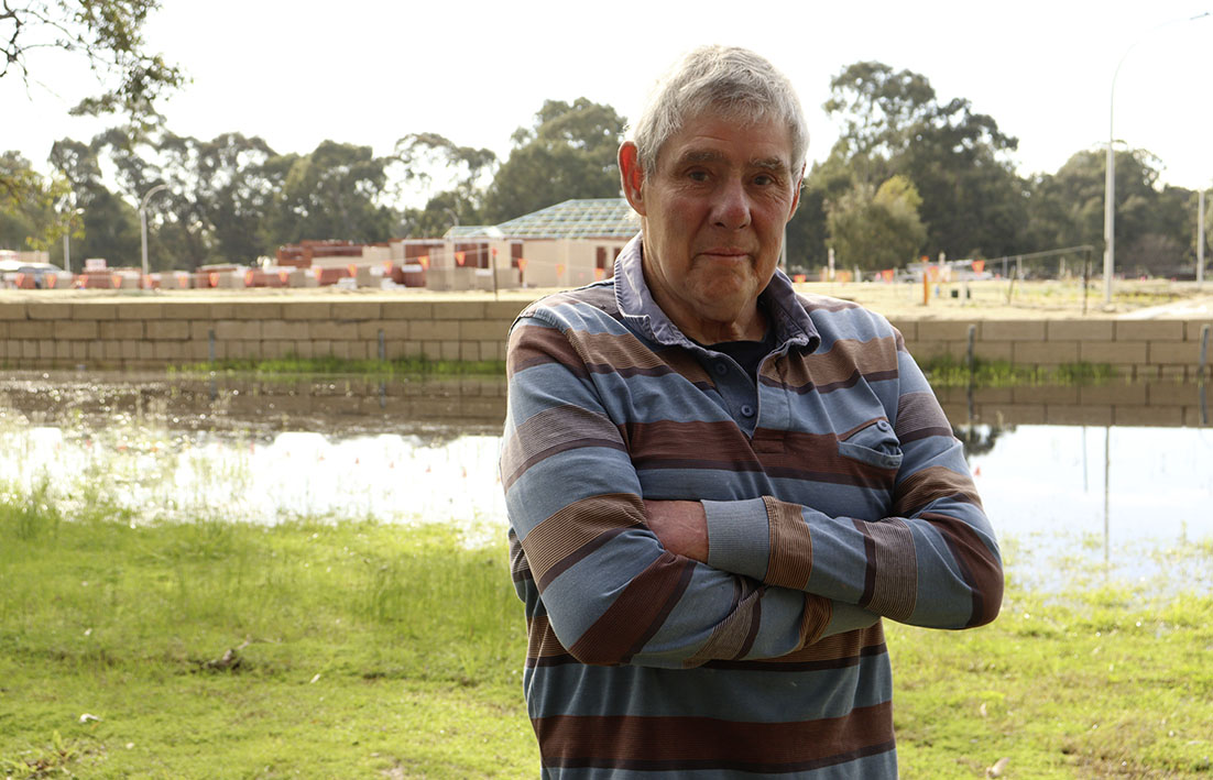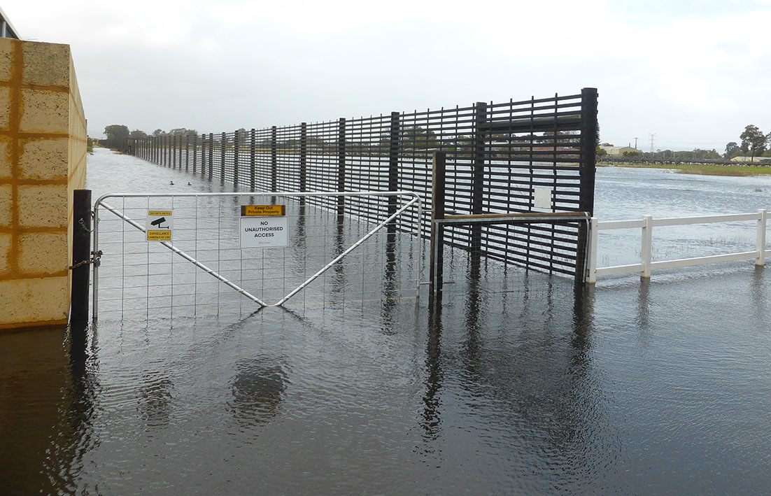
FLOODING and drainage issues, likely exacerbated by rising groundwater due to urbanisation, is evident on a growing number of properties between Benara to Gnangara roads.
Swan Communities Environmental Alliance (SCEA) said this week it was continuing to receive reports of extensive flooding from Swan Valley residents at the rural-urban interface.
Areas not previously inundated on such a scale included Henley Brook, east of a new development north of Park Street; four properties on Robert Street, and rural lots near Malvern Street, West Swan; Victoria Road, Dayton, and Waldeck Road, Caversham.
SCEA vice chair Jan Zeck said rising groundwater associated with new urban development, particularly on sand over clay soils, was well documented.
Ms Zeck said this year had seen a return to average winter rainfall, yet readings have not been unusual and certainly nowhere near the major rain events developers were required to plan for.
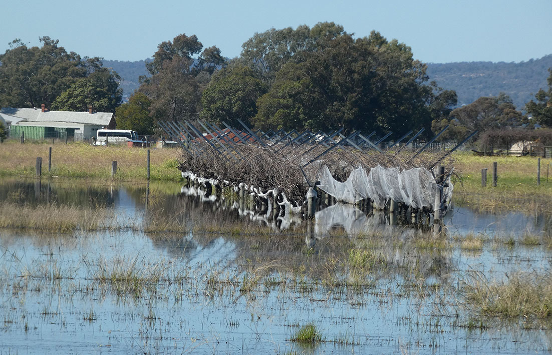
“The riverine floodplain, where new urban development is located, has naturally high groundwater and can be wet during winter.
“But flooding in the past two years, is unusual.
“It is due to rising groundwater at the urban interface, exacerbated by localising urban stormwater discharge.”
She said the new water was not getting away.
“Changes to local hydrology, like filling waterways and wetlands, has directed more urban water into fewer waterways, impacting rural properties with drains or creeks in their vicinity.
“Some residents claim the drainage plans intended to direct this additional water to the Swan River, are not fit for purpose.
“Unfortunately, this situation will not go away, even with lower rainfall, because the water table continues to rise.
“It is starting from a higher baseline each winter (and) homes, properties and livelihoods are now being impacted.’’
Ms Zeck said the nature of development was another contributor.
“When large landholdings are bought for housing, they are often broken up into smaller holdings, each owned and managed by a different developer.
“This piecemeal approach to design and drainage management sees dislocated drainage plans happening haphazardly.
“A better option would be a drainage master plan for the whole floodplain, as is required in many countries overseas.
“The state government and its agencies need to acknowledge there is a problem and start addressing the impacts.
“Locals are extremely concerned that authorities are not taking this situation seriously and community confidence in government institutions and processes must be restored.’’
Recently all City of Swan councillors except for the Mayor Tanya Richardson voted against an officer recommendation to approve a proposed amendment to the Dayton local structure plan No 4.
One of the reasons they voted against the officer recommendation included that the proposal relied on drainage infrastructure in the adjacent Golden Vines subdivision that was not approved through a structure plan modification process and there were many complaints that drainage infrastructure was already inadequate and/or incompetent and would add to the existing unresolved flooding issues in the Dayton area.
Another reason was infilling of any portion of the amendment area would likely increase flooding in adjacent areas.
A final reason was the amendment proposed the original plans for a nutrient stripping drainage swale, which was best practice in accordance with the Dayton local water management strategy, be replaced with an outdated 20th century compensation basin with all of the associated health problems of mosquitos, odour, water stagnation and nutrient overload into waterways and the Swan River.
When urbanisation of areas now known as the suburbs of Dayton and Brabham started the overarching plan for drainage and water management in the area was the Swan urban growth corridor drainage and water management plan published by the Department of Water in June 2009.
The plan offers guidance on water management issues to the City of Swan, the WAPC, land developers and other state agencies in order to facilitate development within the Swan urban growth corridor.
A plan summary said it also assists in integrating land and water planning as required by statement of planning policy 2.9 Water resources (WAPC 2004) and outlined in Better urban water management (WAPC 2008a).
According to the summary all water management strategies, local structure plans, local planning scheme amendments and subdivision plans prepared for areas of proposed new development must demonstrate compliance with the strategies, objectives and design criteria detailed in Swan urban growth corridor drainage and water management plan document.
“A checklist for developers is also provided to aid in the preparation of local water management plans,’’ the summary said.
“Regional scale controlled groundwater levels are established and advice for developers and stakeholders for the management of groundwater quantity and quality within the Swan urban growth corridor is given.
“Section 9 – the implementation section of the plan, presents monitoring requirements for local water management strategies and an implementation action plan.
The plan said the general drainage of Albion (Henley Brook) is south-east towards the Swan River.
“There are three main sub-catchments within this cell, discharging to St Leonards Creek, Wandoo Creek and Horse Swamp respectively.
“The Albion local water management strategy presents the GB Hill & Partners (1995) arterial drainage scheme as the predevelopment drainage network, although it is recognised that Lord Street (now Drumpellier Drive) has been constructed on fill since the GB Hill & Partners (1995) report.
“This has created an artificial catchment boundary between Horse Swamp, Wandoo Creek and St Leonards Creek.
“Pre-development modelling shows extensive flooding in this area and suggests that culverts under Lord Street will be required to re-establish former flow paths.’’
Echo News understands some extra culverts have been added with some long-term residents of the opinion more were necessary.