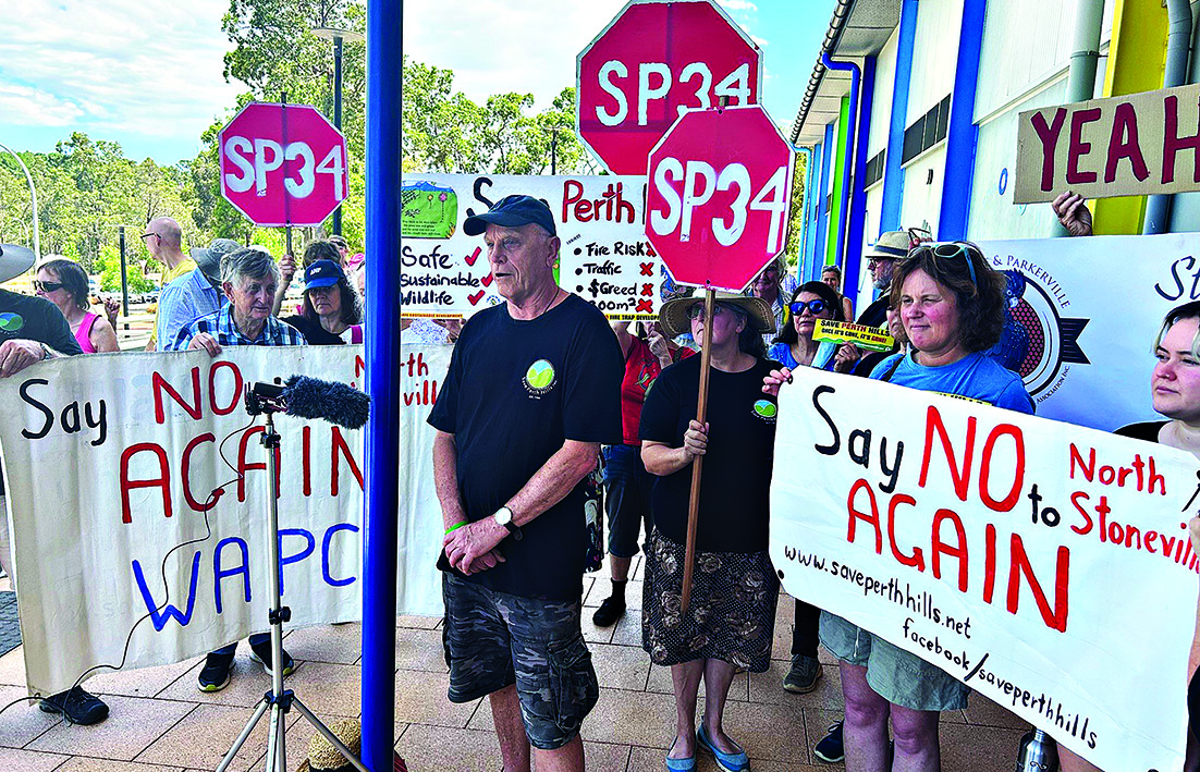
North Stoneville amendment causes concern.
NORTH Stoneville’s public open State Administrative Tribunal (SAT) hearings concluded last week with the third rejection of the plan by the WA planning commission (WAPC) and the Shire of Mundaring and parties awaiting the tribunal’s decision expected in 2026.
In a bid for approval, Satterley revealed it would stage construction and release 135 lots, rather than the intended 1001, pending a decision on Eastlink up Toodyay Road.
Eastlink remains the project that Satterly argued would provide better traffic access away from North Stoneville.
Main Roads WA gave evidence Eastlink might not start until 2036 or 2041.
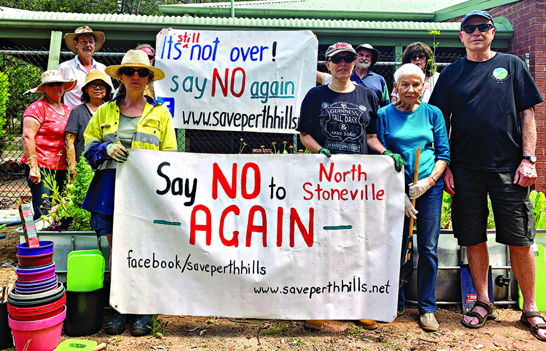
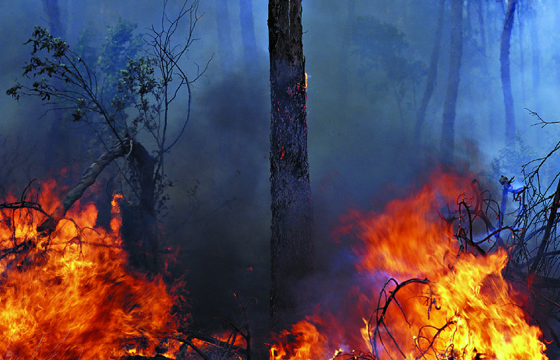
According to Save Perth Hills (SPH), Satterley revealed the 60,000 trees providing shelter and habitat to endangered black cockatoos would need bulldozing to make way for the first stage of 135 lots, regardless if the 1001 lots went ahead in the future.
Earlier in Satterley’s appeal hearing, seeking to overturn the WA Planning Commission’s 2023 rejection of the plan, modification suggestions were introduced such as an on-site bushfire refuge.
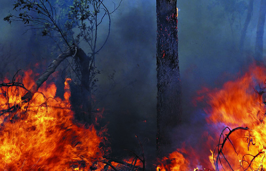
According to the Department of Fire and Emergency Services (DFES), evacuation advice encouraged leaving a bushfire scene early and sheltering at home should be the last option.
Under cross-examination by lawyers for the WAPC, Satterley was unable to provide details on where the refuge would be built, how many people it might hold, what might happen when it reached capacity, who would manage it, and parking arrangements.
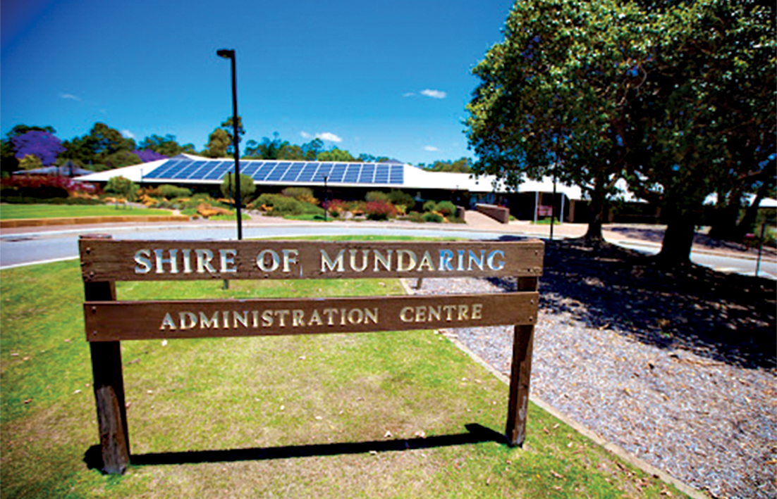
Shire of Mundaring President Paige McNeil said the shire’s submissions to SAT will be released publicly once legal advice confirmed the appropriate timing.
“Council has resolved to refuse structure plan 34 due to concerns around bushfire evacuation risk, traffic impacts and environmental conservation,” she said.
“In 2020, council also resolved to support the rezoning of the land from urban to rural residential.”
Kalamunda MLA Adam Hort said he’d heard from residents concerned about animal habitat loss and bushfire risk and evacuation safety must come first.
“People also understand that we need housing, but there is strong support for the Shire of Mundaring’s proposal to rezone the land to rural residential, rather than the high-density, small-lot model being proposed,” he said.
“Rural residential lots already exist in the area and can accommodate growth without overwhelming the environment or local infrastructure.
“What stood out in the final week of the hearing was the developer’s late proposal to limit development until the Eastlink Road is built, and the suggestion that mass clearing would reduce fire risk, which runs contrary to advice from experts in the field.”
A Department of Planning, Lands and Heritage spokesperson said they could confirm the tribunal heard the North Stoneville Structure Plan appeal’s closing submissions and replies on December 9 and 11, but could not comment further on an active matter.
Echo News put questions to Satterley asking what residents should know ahead of the SAT decision, but no comment was given.
A DIRECTIONS hearing in relation to the North Stoneville structure plan 34 is scheduled to take place in the State Administrative Tribunal (SAT) on August 22.
On Wednesday, July 30 the Department of Planning, Lands and Heritage (DPLH) said Satterley Property Group and the Western Australian Planning Commission (WAPC) were required to file planning expert evidence by Wednesday, August 6.
“By August 6, Satterley must file with the SAT and provide other parties with a document that sets out any modifications it proposes be made to the structure plan lodged on June 14, 2024,’’ a spokeswoman said.
“By August 8, the WAPC and Save Perth Hills (SPH) must file with the SAT and give to the other parties a document which: a. identifies any of the applicant’s modifications which it objects to, b. gives brief reasons for each objection and c. without prejudice to its final position in the proceeding, sets out any alternative or additional modifications to the structure plan that it will contend at the hearing that the applicant should be required to make if the SAT does not consider that the structure plan should be refused.
“Satterley, the WAPC, SPH and the Shire of Mundaring must file written opening submissions by Friday, August 15.’’
In February this year SAT, which is reviewing the refusal of North Stoneville SP 34 gave approval for the shire to make submissions and for SPH to intervene, subject to certain conditions.
This week SPH said this would allow them to have five community witnesses and one expert witness at the appeal hearing scheduled for September.
SPH acting chair Debra Bishop said SPH had managed to have one of its expert witnesses Dr Ken Strahan attend pre-appeal legal conferrals in July involving Satterley’s “substituted’’ bushfire management plan and traffic modelling for the proposed North Stoneville development.
She said traffic gridlock risks and potential entrapment of thousands of people during bushfires had been major factors in the community’s three decades of opposition and the “reasons for numerous formal rejections of Satterley’s plans since 2020”.
“To the credit of our SPH community-funded lawyers and a ruling by WA’s SAT, Dr Strahan was given the go-ahead to attend all three bushfire and traffic-related expert conferences,’’ she said.
According to his LinkedIn profile Dr Strahan from Strahan Research is a researcher with 44 years experience in market research, economic consultancy, industry analysis and public policy development.
“He has been involved in bushfire research in Australia for 30 years,’’ his profile said.
“His doctorate on household decision-making in bushfire identified factors that predict evacuation in bushfire and established the concept of evacuation archetypes.
“He has presented papers to international conferences on bushfire research.’’
The proposed development has caused controversy for years.
Concerns raised about North Stoneville reported that former WA fire and emergency chief Wayne Gregson had told a SPH rally that his experience caused him to be concerned about the risks of another ‘unprecedented’ bushfire catastrophe involving North Stoneville.
In March 2023 Greens MLC Brad Pettitt referred to Amended North Stoneville plan out for public comment in the Legislative Council.
Mr Pettitt asked questions about the dates documents relating to the replacement part 3B of the amended structure plan – the bushfire simulation modelling report, the microsimulation evacuation modelling report and the most recent version of the bushfire management plan – were received by DPLH.
He also asked on what date the initial version of appendix 3B was received by DPLH.
The then leader of the Upper House Sue Ellery answered on behalf of then Planning minister Rita Saffioti saying the three documents were received on February 21, 2023 and the appendix was received on February 1, 2023.
Some election candidates from both sides of politics were against the proposal and also disagreed with then Environment and Water minister Tanya Plibersek’s environmental approval of the proposed development as reported in Environment minister’s approval ties in habitat offsets.
In North Stoneville bushfire simulation impresses CSIRO it was reported the bushfire simulation modelling carried out for the amended North Stoneville structure plan part 3B had attracted support from the leader of the CSIRO bushfire behaviour and risks team Dr Andrew Sullivan who told Echo News the company behind the bushfire modelling report had gone to great lengths to make it as bullet-proof as they could.
SATTERLEY has been given a June deadline to file a further ammended North Stoneville SP34 by the State Administration Tribunal (SAT) with strict parameters in place for any third party interventions or submissions.
On March 8 SAT made orders to progress the matter with Satterley required to file a further amended structure plan by June 14.
According to a SAT third party participation in planning matter info sheet there are four ways – being called as a witness by the respondent, making submissions under section 242 of the Planning and Development Act 2005, intervening in a proceeding under section 37(3) of the State Administrative Tribunal Act 2004, and possible participation in mediation.
Being called as a witness usually involves giving evidence on behalf of a respondent – in the case of the North Stoneville structure plan the applicant is Satterley Group while the respondent is the Western Australian Planning Commission (WAPC).
Regarding intervention the State Administrative Tribunal Act 2004 says the Attorney General may, on behalf of the state, intervene in a proceeding of the tribunal at any time and the tribunal may give leave at any time for a person to intervene in a proceeding on conditions, if any, that the tribunal thinks fit.
A North Stoneville update by the Department of Planning, Lands, and Heritage (DPLH) – listed on the state government’s website – said following the submission of a further amended structure plan the respondent and applicant would each file a statement of issues, facts, and contentions and documents relevant to their case by July 12 and August 9 respectively.
“Applications to intervene under section 37(3) of the State Administrative Tribunal Act 2004 or to make submissions under 242 of the Planning and Development Act 2005 are to be made to the tribunal by August 23,’’ the update says.
This follows an earlier advice note by the WAPC when it refused the amended structure plan on December 7 last year saying there were typographical and reference inconsistencies and discrepancies in the structure plan documentation that needed to be addressed.
The SAT third party participation in planning matters info sheet said a third party should usually first speak to the respondent or its representative if they wish to give evidence.
“Anyone giving evidence to SAT usually needs to prepare a witness statement of their evidence,” the info sheet said.
The DPLH update said Satterley is allowed to address the errors and provide clarification about certain issues to help streamline a final hearing for determination by SAT.
“The order does not allow the applicant to substantially change the structure plan proposal,’’ the update says.
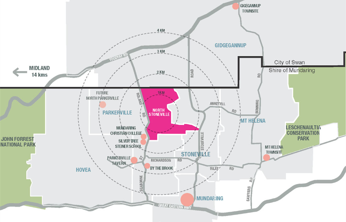
North Stoneville, which proposes a new townsite in the Perth Hills, was first refused by the WAPC in July 2020.
Satterley then applied for a SAT review of the WAPC’s refusal and in November 2022 ordered the applicant (Satterley) to provide an amended structure plan and supporting information to the respondent (the WAPC) and also asked the respondent to reconsider their refusal.
The amended structure plan was advertised for public comment between March 10 and May 8 last year.
Interested parties including the community, Save Perth Hills, the Shire of Mundaring, the City of Swan, and government agencies such as the Department of Fire and Emergency Services were invited to provide comment.
The WAPC was given an extension to reconsider the amended structure plan to allow referral agencies more time to assess Satterley’s traffic and bushfire modelling.
On December 7 last year, the WAPC refused the amended structure plan following the recommendation of the statutory planning committee on November 30.
ON February 2 the State Administrative Tribunal granted orders for the amended North Stoneville structure plan 34 to be listed for a directions hearing on March 8.
The Department of Planning said it was likely on that date that the tribunal would start scheduling the matter towards a final hearing for a decision about the amended structure plan.
In ‘North Stoneville row not over until Satterley walks’ (Echo News, December 15) reported that although the Western Australian Planning Commission (WAPC) had again rejected the amended structure plan at its December 7 meeting, the disagreement between Satterley and the WAPC was headed back to SAT in 2024 unless the developer and the landowner walked away from the development.
In a statement on December 22 Shire of Mundaring President Paige McNeil, who is a former Save Perth Hills chair, said the December 7 decision was the latest in a series of refusals for the planning application.
SHIRE of Mundaring has welcomed the Western Australian Planning Commission’s (WAPC) decision to refuse the North Stoneville structure plan proposal.
At its meeting on Thursday, December 7 the WAPC resolved to refuse the structure plan, based on the plan’s inability to adequately demonstrate the threat of bushfire risk, including safe evacuation, as well as the true impact of traffic on the road network.
Shire of Mundaring President Paige McNeil and deputy Trish Cook provided a deputation to the WAPC on behalf of council at its public hearing on Thursday, November 23 along with 22 verbal and nine written deputations.
Ms McNeil said that the December 7 decision was the latest in a series of refusals for the planning application.
“The recent refusal by the WA Planning Commission endorses council’s and our community’s long held concerns about an urban development at North Stoneville,” she said.
“The decision is a testament to years of persistence by council and our community who understand the increasing bushfire risk that we face in this region. The decision tells us that planning in bushfire prone areas must aim to safeguard not endanger our community.”
WAPC noted that the traffic, evacuation and bushfire analysis and modelling could not adequately demonstrate community safety and the protection of environmental conservation values cannot be appropriately balanced with the outcomes of bushfire risk management.
The matter will now return to the State Administrative Tribunal (SAT) on February 2.
The applicant can then decide whether to withdraw or proceed to a final hearing with SAT as the decision maker.
SAVE Perth Hills has had a win with the WAPC rejecting North Stoneville again but unless Satterley decides to walk away the next part of the process will be a directions hearing in early 2024.
After its December 7 meeting where it rejected the amended North Stoneville SP34 the Western Australian Planning Commission (WAPC) said the next directions hearing in the State Administrative Tribunal (SAT) review proceedings was scheduled for February 2.
If approved North Stoneville will provide about 1000 lots to accommodate about 2800 residents, two schools, a small local centre, extensive areas of open space and servicing infrastructure.
The initial application was lodged in August 2019 and refused by the WAPC in July 2020.
Satterley appealed the decision and SAT invited the WAPC to reconsider an amended version of the structure plan.
Last week the WAPC said it refused North Stoneville again because the amended structure plan did not adequately demonstrate the threat of bushfire risk, including safe evacuation, having regard to the intent and objectives of State Planning Policy 3.7 Planning in Bushfire Prone Areas, as well as the true impact of traffic on the road network.
The WAPC’s decision follows the recent recommendations made by its statutory planning committee (SPC) and the Department of Planning, Lands and Heritage (DPLH).
Prior to Thursday’s meeting, the SPC and WAPC heard deputations from 21 parties, including the developer Satterley Property Group, the Shire of Mundaring, individuals and community groups.
The WAPC said the decision came after more than four years of consideration of the proposed SP34, which included extensive land use planning assessment.
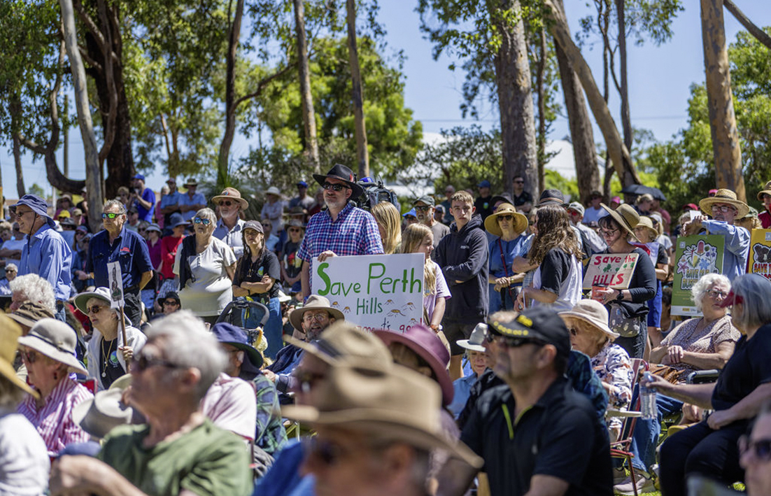
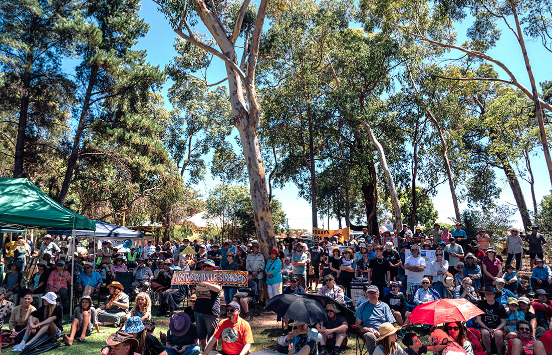
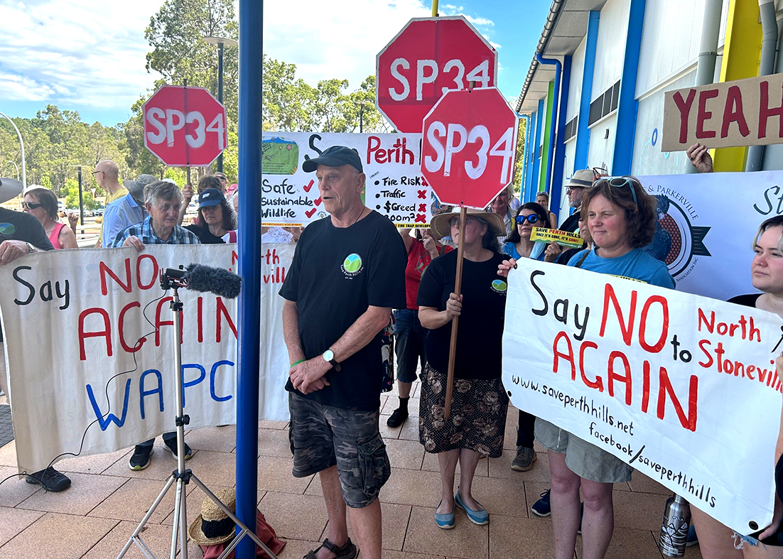
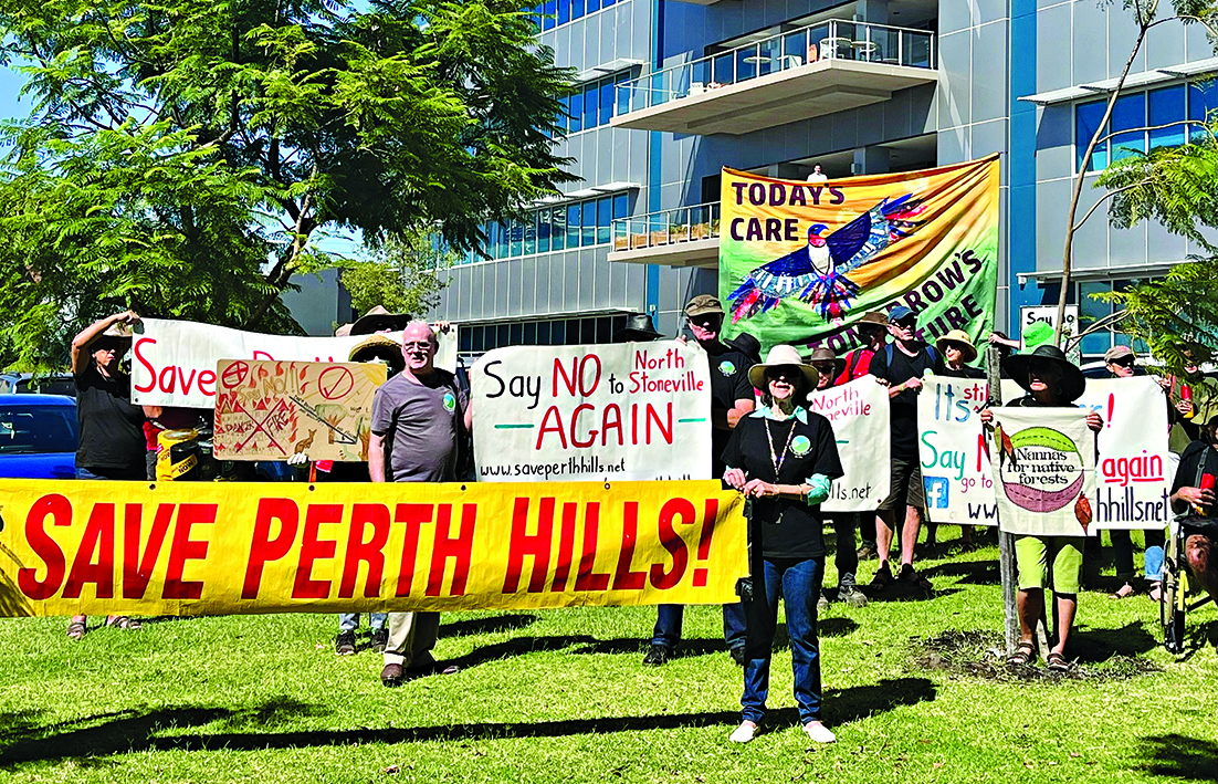
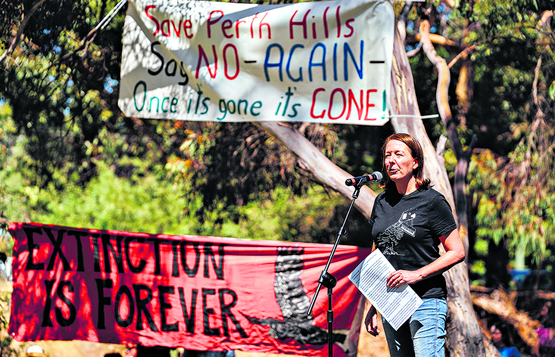
Save Perth Hills called the WAPC decision a win for common sense and called on Satterley and the landowners to accept the umpire’s decision saying it had spearheaded the community battle against the proposed development since 1991.
SPH chair Peter Brazier said the Mundaring community had stood firm for 32 years and their efforts had been vindicated with the decision suggesting there was a limit to planning when the lives of people could be at enormous risk.
WAPC’s statutory planning committee minutes for November 30 acknowledged the 22 verbal and nine written deputations that were heard at a meeting in Mundaring on Thursday, November 23.
Hasluck MHR Tania Lawrence and community members were among those to provide deputations.
At the meeting WAPC chairman David Caddy declared a perceived impartiality interest informing members he was an office bearer within the Lay Anglican Church – the landowners within the structure plan area.
“Mr Caddy was not present during the discussion and/or decision-making procedure on the item,’’ the minutes said.
North Stoneville bushfire simulation impresses CSIRO (Echo News, April 14) on the bushfire simulation modelling carried out for the amended North Stoneville structure plan Part 3B attracting support from the leader of the CSIRO bushfire behaviour and risks team resulted in letters from firefighters – some in support and others against his comments.
Satterley Property Group was contacted for comment.
THE statutory planning committee is recommending the Western Australian Planning Commission refuse the North Stoneville structure plan 34 at its Thursday, December 7 meeting.
On Thursday, November 23 the WAPC was due to hear deputations and comments on the item at a joint-meeting held at Mundaring Arena.
Earlier this week Save Perth Hills (SPH) said it had every reason to be confident the WAPC would endorse the recommendation to refuse the proposal, which is also opposed by the City of Swan and Shire of Mundaring.
SPH chair Peter Brazier said the recommendation for refusal tells Satterley and the landowner, the Anglican Church, yet again that their proposed North Stoneville townsite was too dangerous and too environmentally destructive and it should be rejected by the WAPC.
According to the WAPC statutory planning committee, Satterley’s amended structure plan did not demonstrate that the threat of bushfire risk to people, property, and infrastructure could be appropriately mitigated.
Echo News asked the leader of the CSIRO bushfire behaviour and risks team Andrew Sullivan to comment. In April he said the bushfire simulation models in the amended plan used the CSIRO-developed program SPARK and adopted bushfire rate of spread models, as recommended by the CSIRO publication A Guide to Rate of Fire Spread Models, which were suitable for modelling bushfires in the Perth Hills.
But on Wednesday a CSIRO spokeswoman said the Australian government scientific research agency did not want to comment at this stage.
The statutory planning committee recommendation to refuse said the technical information submitted in support of the amended structure plan, including traffic, evacuation and bushfire analysis and modelling, did not include adequate or accurate details to demonstrate that the risk of impacts from a bushfire, including safe evacuation in a bushfire emergency, was acceptable.
It also said that insufficient information was provided to identify that the protection of environmental conservation values could be appropriately balanced with the outcomes of bushfire risk management in perpetuity, including identification of appropriate management authorities responsible for maintaining conservation and bushfire outcomes.
The recommendation said refusing the application was warranted, given that adequate and accurate information to demonstrate that the threat of bushfire risk was acceptable had not been provided.
Also the recommendation said the true impact of traffic on the road network to provide for appropriate local and regional transport network outcomes had not been demonstrated.
It also advised the applicant there were typographical and reference inconsistencies and discrepancies throughout the different documents forming the amended structure plan, that in any event would need to be addressed in order for the amended structure plan to receive a final determination.
The WAPC’s decision on the amended structure plan is due to be made public by December 18 with a State Administrative Tribunal directions hearing set for February 2.
Published Echo News June 9, 2023
THE City of Swan includes concerns about having to contribute to road upgrades and the extent and sequence of changes proposed to the road network among reasons why it cannot support the amended North Stoneville SP 34 proposal.
Swan councillors voted unanimously to advise the Western Australian Planning Commission (WAPC) the amendment put forward by Satterley Property Group could not be supported because the application did not provide any confirmation that the city would not be required to contribute towards roads, infrastructure or other upgrades required within the city’s municipal jurisdiction for the development to proceed.
A motion moved by councillor Aaron Bowman and seconded by councillor Cate McCullough in May said the application also included ambiguities regarding the extent and sequencing of changes proposed to the road network which could have further implications for the city in relation to the impact of road or infrastructure upgrades.
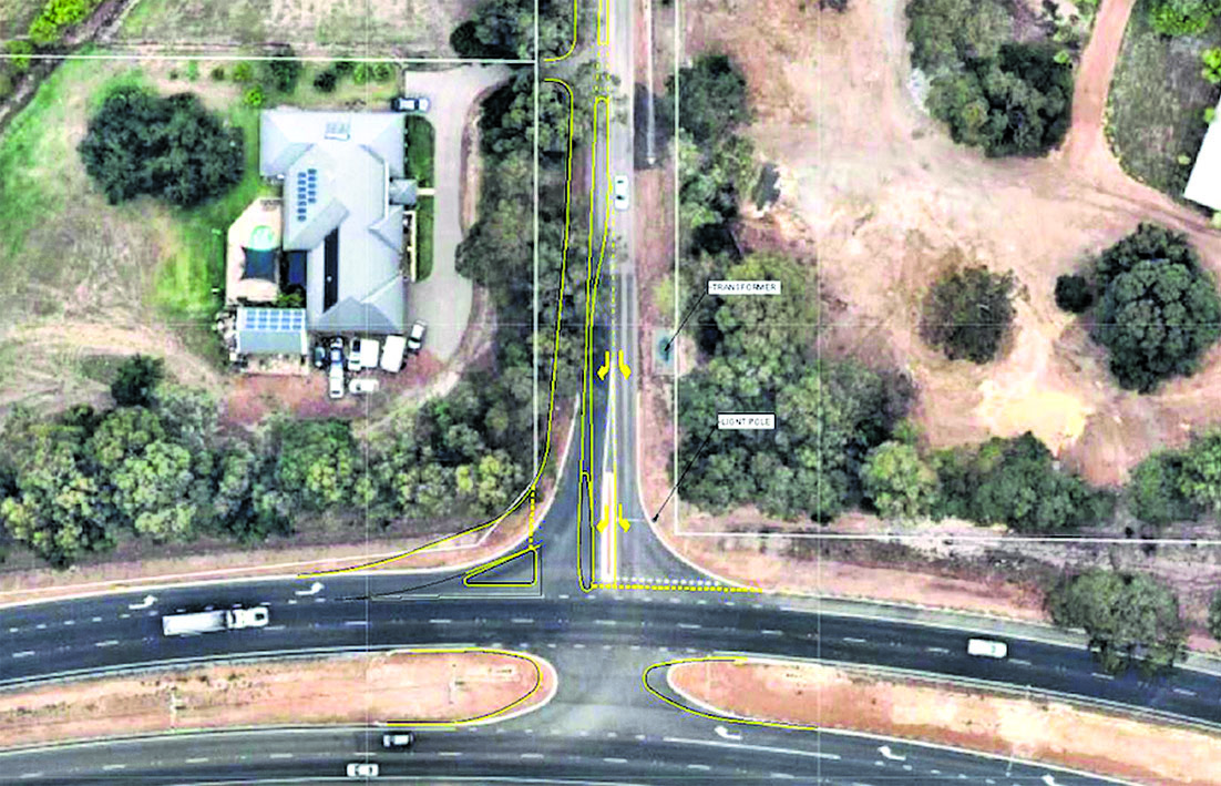
The officer’s report for the May council meeting said a number of upgrades were proposed for the amended structure plan with those in the city’s boundaries including construction of the missing portion (~210m) of road between Hawkstone Street and Woolhouse Lane (previously known as Cameron Road) and their intersections.
Also included are upgrades to the intersection with Toodyay Road at Roland Road and Stoneville Road.
“Main Roads WA has jurisdiction to comment on the suitability of upgrades at Toodyay Road-future EastLink,’’ the officer’s report says.
“Preliminary review of the anticipated traffic volumes relative along Hawkstone Street and Woolhouse Lane (once connected) and Roland Road-Stoneville Road indicates that they would operate within acceptable technical tolerances.
“But there may be local amenity concerns with an overall increase in traffic.’’
Intersection upgrades within the Shire of Mundaring include Great Eastern Highway and Seaborne Street, Roland Road and Stoneville Road.
The North Stoneville revised transport impact statement mentions a number of road and intersection proposals including a proposed Hawkstone Road and Cameron Road connection.
“It is understood that the current disconnection between Hawkstone Road and Cameron Road will be addressed in the future and prior to 2031 so that two roads form a continuous east-west link providing convenient and legible connection between Roland Road and Stoneville Road along the northern LSP boundary,’’ the revised transport impact statement said.
Another is a proposed Great Eastern Highway and Seaborne Street intersection upgrade concept, which the revised transport impact statement said would require upgrades before 2031 assuming EastLink had not been constructed by that point.
“The upgrade is required to improve the current capacity and operation of this intersection under normal traffic activities and in particular in case of bushfire emergencies prior to implementation of EastLink in 2031 and beyond.’’
According to Main Roads WA EastLink will provide a safer, more efficient route between Perth and Northam, to cater for a future increase in regional and interstate freight movement and projected growth in local population.
But there is currently no funding for the construction of the highway between Middle Swan and Northam.
Published Echo News April 14, 2023
THE bushfire simulation modelling carried out for the amended North Stoneville structure plan Part 3B has attracted support from the leader of the CSIRO bushfire behaviour and risks team.
Dr Andrew Sullivan told Echo News the company behind the bushfire modelling report had gone to great lengths to make it as bullet-proof as they can.
“The science that they’ve employed to do this is basically the best available for that job and they’ve gone to great lengths to try and ensure that it is as meaningful and applicable as possible to the conditions,’’ he said.
The report by Strategen JBS&G said while the simulated design bushfire scenarios represented the worst credible case bushfires for a 1:50 year weather event, they do represent a “perfect storm” of conditions that while possible, had historically rarely occurred in unison.
“On this basis, we are comfortable that there is sufficient conservatism embedded in the model inputs to ensure that an actual bushfire would be slower and smaller than what is being represented in the simulations over the first four hours, and likely considerably slower and smaller,’’ the report said.
Dr Sullivan said most rural fire agencies in Australia had some role in the planning process so the planning office need to go to the rural fire service to get their opinion on some planning proposals.
“But what they normally have to comment on is not that detailed,’’ he said.
“The amount of effort these people have gone into to do the simulations to consider all of the likely inputs in terms of the weather and fuels and their consideration of both the growth phase and what they call the mature phase of fire spread, the locations of the fires, the prevailing weather and the fact that they’ve bumped up the actual historical weather to be more representative of the increased fire danger index values in the two that they did - that is a lot of work and it’s as comprehensive as I’ve seen.’’
The report’s conservative vegetation values met with his approval.
“They state the forest hasn’t been burnt for 25 years – that is quite considerable, if you look at the average fuel age in the Perth Hills it’s going to be somewhat less than that.”
He gave two reasons for bushfire simulation models using the CSIRO-developed program SPARK and adopting bushfire rate of spread (RoS) models as recommended by the CSIRO publication A Guide to Rate of Fire Spread Models being suitable for modelling bushfires in the Perth Hills.
“(First) the forest model – the one they call VESTA – or the dry eucalypt fire model is intended for use in dry wood forests – all different species of dry eucalypt forest and what’s in the Perth Hills is specifically a dry eucalypt forest.
“The second thing is that the research work that we did to develop that model was actually done in Western Australia in jarrah forest.
“So of all places in the country where the model is applicable in dry eucalypt forest is in jarrah forest in Western Australia.’’
On March 28 Save Perth Hills (SPH) said Satterley had failed the bushfire prone Perth Hills’ community again by presenting an inferior ‘amended North Stoneville plan’ featuring unrealistic bushfire evacuation models, a development that requires unacceptable levels of environmental destruction and creates local traffic impacts of at least 8000 extra traffic movements on surrounding rural roads, every day.
Published Echo News March 17, 2023
THE amended North Stoneville SP 34 is now available for public comment.
A replacement Part3B of the amended structure plan was submitted by Satterley on February 20, which according to Department of Planning, Lands and Heritage has been incorporated into the amended structure plan documentation.
The amended structure plan is now being advertised for public comment for a minimum period of 42 days.
DPLH said interested parties including the community, the Shire of Mundaring, the City of Swan and government agencies such as the Department of Fire and Emergency Services are invited to provide comment on the amended structure plan.
On Tuesday about 50 Save Perth Hills (SPH) supporters protested outside Satterley’s against the proposed North Stoneville development.
After the Satterley protest SPH went to Parliament House to handover a petition of 2500 signatures to Greens MLC Dr Brad Pettitt and Labor’s East Metropolitan MLC Lorna Harper.
The petition seeks to have the government reverse its rejection of a key Wooroloo Bushfire Inquiry recommendation, that DFES be granted decision-making powers to have the final say on housing development approvals, such as North Stoneville, when they’re located in extreme bushfire zones.
An SPH spokesperson said they examining the amended plan with its subject matter experts and would soon provide an easy-to-follow summary for people interested in preparing a submission.
The revised structure plan identifies the future proposed land uses within the project area as including three separate villages, residential land uses comprising, 42 natural living lots (average 1ha), 647 suburban lots (average 1700sqm), 312 village urban lots (average 1200 sqm), a local centre, two educational sites, recycled wastewater infrastructure, internal road network and 22 areas of public open space (POS), including local/active POS, conservation POS and special sites.
It also includes creek corridors and drainage basins, bushfire emergency and fire service access routes and multiple connections to the surrounding existing public road network.
North Stoneville SP 34 is expected to be developed over about a 15-year time period, with staggered subdivision stages.
Construction is anticipated to commence within village 2 with initial access from Roland Road.
The revised structure plan says existing public roads will be upgraded to provide for a road network that can support the planned population growth in both normal and emergency conditions.
“As part of this process, DPLH will also invite submissions/recommendations from the Shire of Mundaring and other government agencies, including DFES.’’
Satterley’s promotion for the proposed development says concentrating growth in and around townsites has been the preferred means of residential development by both state and local governments for a multitude of reasons, including creating environmental benefits like irrigation of public open spaces using wastewater recycling, rehabilitation of creek lines and balancing clearing of vegetation with bushfire risk management.